
Remote Sensing as a mitigation tool
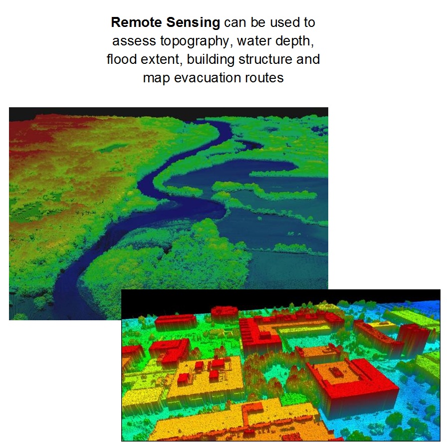
Remote Sensing can be used in various ways to develop emergency plans as well as mitigation plans before a disaster happens.
Image Type
Category
Level
Source
http://ipler.cis.rit.edu/flood